
Central to PSMNR is the support of the management of the Mount Cameroon, Korup and Takamanda National Parks as well as Banyang-Mbo Wildlife Sanctuary.
The interventions of the Protected Area Services financed by PSMNR in and around the National Parks and the Wildlife Sanctuary are guided by a Collaborative Management (CM) approach. In this approach Protected Area Services and villagers are seen as partners seeking collaboration, in order to ensure protection of the national parks for the benefit of all.
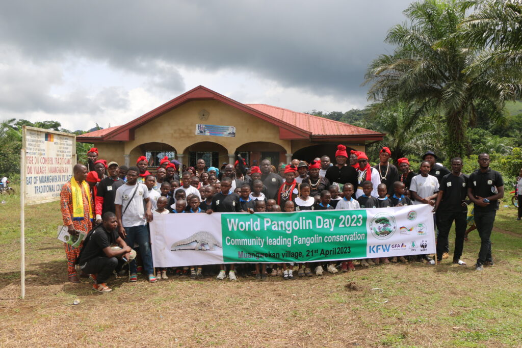
The support of Banyang Mbo Wildlife Sanctuary has started in PSMNR-SWR Phase II. Support has been focused on establishing a functional Sanctuary service; improve on law enforcement and more recently to put in place the institutional basis for the co-management (Village Forest Management Committees, cluster platforms, cluster facilitators).
Since the beginning of 2015, some villages of Banyang-Mbo Wildlife Sanctuary have been participating in the NTFP commercialization project.
29 villages are adjacent to the Wildlife Sanctuary fall under four Sub-divisions that is, Upper Banyang, Nguti, Bangem and Melong. In particular in the Mbo Hinterland the villages are quite enclaved and often only accessible from the Littoral Region by footpaths.

Gazetted in 1986 the Korup National Park (KNP) covers a surface area of 126,900 ha. The park has a high level of endemism and supports populations of medium and large mammals. KNP is the oldest national park of the lowland rainforest of Cameroon. Arguably, the park is the most species-rich African Rainforest for which comparable data exist.
The goal as stated in the present management plan is to assure the management of biodiversity and the maintenance of the integrity of KNP and to contribute to socio-economic development at local, regional, national and sub-regional levels through the full involvement of all stakeholders. The management plan will be reviewed in 2015.
The park and peripheral zone include 32 villages (five in-park and twenty-seven peripheral villages, some of which are less than 500m to the park boundary) with a population between 5-6000 inhabitants that depend almost exclusively on the park and peripheral zone resources for subsistence. Since the western boundary of the park coincides with the Cameroon-Nigeria international boundary, villages on the other side of Nigeria have a direct influence on the management of the park; necessitating a trans-boundary collaboration.
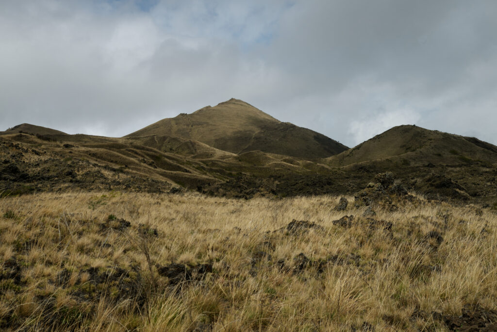
The National Park was created in 2009. It covers a surface area of 58,178 ha. It is a huge volcanic mass with the main peak of about 4,100 m. The Mount Cameroon is the highest mountain in West and Central Africa with the peak just about 20 km inland from the Atlantic coastline. It is an active volcano. The last eruption occurred in 1999 with minor tremors and lava flows in 2000.
The Mt. Cameroon area supports forests known to be of exceptional scientific, economic and social value, containing a great variety of endemic and endangered flora and fauna species, supplying many commercial and subsistence forest products, as well as providing valuable ecosystem services such as watershed protection. Mount Cameroon is a biodiversity hotspot and is the most diverse ecosystem in Cameroon and is presented as the 10th most conservable places in the world (IUCN 1994).
The rich volcanic soils, coupled with the accessibility of the area by road and waterway partly accounts for increasing immigration into the area. The area is densely populated by a population of about 450,000 persons, with about 75 % dependent on exploitation of land and forest resources for their livelihood. Only 23% of the population is indigenous: Bakweri and Bomboko.
Currently the park is working together with 41 communities directly bordering the Park with a population between 40 and 14,000. The management plan has been set up in 2014. The global objective is to conserve the mountain ecosystem and its environmental services through collaborative management while promoting ecotourism.
Gazetted in 2008 the Takamanda National Park (TNP) covers a surface area of 67,600 ha. The park is an important biodiversity hotspot with endemic species, in particular the critically endangered Cross River Gorilla. The area is as well an important watershed for the Cross River basin.
The forest and vegetation formations of the Takamanda National Park are rich and diverse, qualities that are enhanced by the preponderance of micro habitat types with a unique representation of a sharp gradation from lowland forest to montane (highland) forest that show an associated floristic variations.
Since the western boundary of the park coincides with the Cameroon-Nigeria international boundary, villages on the other side of Nigeria have a direct influence on the management of the park; necessitating a trans-boundary collaboration.
The objective of the park is to conserve the biodiversity of Takamanda National Park and its periphery with the participation of all stakeholders while contributing towards the sustainable development of local communities. Currently the park service is collaborating with 18 communities in and around the park.

The Programme for the Sustainable Management of Natural Resources (PSMNR) in the South West Region of Cameroon has significantly contributed to the collaborative management of Bakossi National Park. Through the establishment of Cluster Conservation and Development Agreements (CCDAs), PSMNR has facilitated the engagement of local communities in the park’s management. The programme has supported the creation of community white pepper farms in 20 communities, providing a sustainable revenue source and promoting conservation. Hunters have been identified and trained in alternative livelihoods such as modern beekeeping and piggery, reducing poaching activities. Additionally, community-based surveillance efforts have led to the dismantling of over 3,000 wire traps and the collection of 500 empty cartridge shells. These initiatives have not only enhanced the protection of Bakossi National Park’s rich biodiversity but also improved the socio-economic conditions of the local communities, fostering a sustainable and collaborative approach to conservation.
